





Walking & Hiking
Trails & Long Walks
The best walking & hiking in Fleurieu Peninsula
The Fleurieu is the start of the epic Heysen Trail and is crossed by the Kidman Trail and dozens of short coastal walks. From half-hour lookouts to multi-day trail sections, every level of walker is catered for.
Read our guide to walking & hiking ↓Browse walking & hiking by area
Map shows the 22 places on this page.
Kuitpo Forest
View →A working pine and native forest with trails, picnic spots and treetop adventure
A 3,600-hectare ForestrySA reserve of softwood plantations and remnant native bushland in the South Mount Lofty Ranges, criss-crossed by walking, mountain bike and horse trails 45 minutes from Adelaide.
Kyeema Conservation Park
View →A 347-hectare stringybark forest reserve adjacent to Kuitpo Forest, with 80+ bird species including beautiful firetail and chestnut-rumped heathwren.
Mount Billy Conservation Park
View →A high-rainfall conservation park in the Inman Valley protecting some of the last Fleurieu Peninsula swamps and a network of bushwalking tracks through tall stringybark forest.
Mount Magnificent Conservation Park
View →A 90-hectare conservation park north-east of Mount Compass with a 3.5 km Heysen Trail summit loop offering big views to Lake Alexandrina, the Coorong and the coast.
Murray Mouth
View →Where Australia's greatest river meets the Southern Ocean
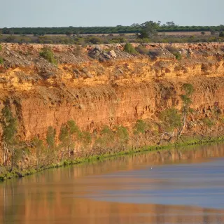
The opening where the River Murray - Australia's longest river - meets the Southern Ocean, about 10km southeast of Goolwa in the Coorong National Park.
Myponga Reservoir Reserve
View →Walking, kayaking and fishing at a SA Water reservoir
A 250-hectare SA Water reservoir opened to the public for walking, kayaking, fishing and picnics, with a spectacular lookout over the dam wall and spillway.
Newland Head Conservation Park
View →A coastal reserve south-west of Victor Harbor protecting Waitpinga Beach, Parsons Beach and the spectacular cliffs of the Wild South Coast Way - the Heysen Trail's most dramatic Fleurieu section.
Old Noarlunga
View →1840s river village on the Onkaparinga
Historic 1840s river township on the Onkaparinga River, tucked inside a dramatic river bend near Onkaparinga River National Park.
Old Willunga Hill
View →The Tour Down Under's most famous climb
The 3-kilometre winding ascent out of Willunga onto the Willunga Scarp is South Australia's most famous cycling climb, with panoramic Gulf views from the top.
Onkaparinga River National Park
View →A dramatic gorge just 35km south of Adelaide
A stunning river gorge and surrounding bushland just 35km south of Adelaide, with clifftop lookouts, riverside walks and rock pools teeming with wildlife.
Onkaparinga River Recreation Park
View →A 250-hectare estuarine recreation park where the Onkaparinga River meets the sea - distinct from the upstream Onkaparinga River National Park, with quiet walking trails and rich birdlife.
Petrel Cove
View →A dramatic cliff-backed cove between Kings Beach and The Bluff at Encounter Bay - one of the best whale and dolphin viewing spots on the Heritage Walking Trail.
Ridgetop Retreats $$$$
View →Max Pritchard eco cabins in Deep Creek
Four award-winning Max Pritchard eco cabins perched on a ridge in the stringybark forest of Deep Creek National Park, near Delamere.
SeaLink Cape Jervis Ferry Terminal
View →The departure point for daily SeaLink ferries to Kangaroo Island - the defining infrastructure of Cape Jervis township and a Backstairs Passage viewing point in its own right.
Spring Mount Conservation Park
View →A 270-hectare bushland reserve south-east of Myponga, on the Heysen Trail, with diverse native bird and mammal habitat and quiet bush walking.
Stringybark Campground
View →Deep Creek's most developed campground - 16 sites, hot showers and toilets - the central base for hikes into the park.
Tapanappa Lookout
View →The signature clifftop lookout in Deep Creek Conservation Park - dramatic views over the Southern Ocean cliffs and across to Kangaroo Island, a short walk from the Tapanappa campground.
The Bluff (Rosetta Head)
View →A 97-metre granite dome above Encounter Bay
The dramatic granite headland known locally as The Bluff - a 97m dome overlooking Encounter Bay, with a 19th-century whaling history and a short, steep walking trail to the summit.
Trig Campground
View →A spacious kangaroo-frequented campground in Deep Creek Conservation Park with fire pits and a picnic shelter - quieter than Stringybark, with no showers.
Tunkalilla Beach
View →A wild 5km Southern Ocean surf beach inside Deep Creek National Park, accessible via Tunkalilla Road and the Heysen Trail - one of the most remote beaches on the Fleurieu.
Waitpinga Cliffs Walk
View →Dramatic Heysen Trail coastal section
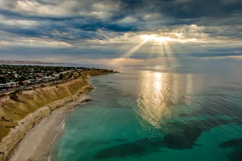
A spectacular section of the Heysen Trail along the high sandstone cliffs between Waitpinga Beach and Kings Beach in Newland Head Conservation Park.
Wangkuntila–Aldinga Conservation Park
View →A rare pocket of original coastal scrub
One of the last remnants of original coastal vegetation on the Adelaide plains, with sandy walking tracks, native woodland, wetlands and abundant birdlife.
About walking & hiking in Fleurieu Peninsula
For walkers, the Fleurieu Peninsula is where South Australia's most famous long-distance trail begins. The Heysen Trail starts at the lighthouse at Cape Jervis and threads north through Deep Creek National Park - the largest area of natural bushland on the peninsula - past clifftop lookouts, hidden beaches and forested gullies.
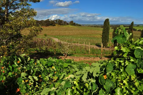
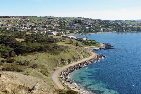
You don't need to be a long-distance hiker to enjoy it. The Fleurieu is laced with short, rewarding walks: tiered waterfalls like Ingalalla and Hindmarsh Falls that run best after winter and spring rain, coastal clifftop trails around Victor Harbor and the Bluff, and gentle rail trails such as the Encounter Bikeway and the Shiraz Trail through the McLaren Vale vineyards.
Walks here range from easy 30-minute strolls to full-day Grade 4 hikes, so check the distance and grade before you set out. The cooler months from autumn to spring are the most comfortable for walking, and spring brings wildflowers to the conservation parks. Carry water, sun protection and a charged phone - many trails are in remote country with patchy reception - and always check park alerts for seasonal closures and fire-danger days.
Walking & Hiking in Fleurieu Peninsula - frequently asked questions
What is the Fleurieu Peninsula known for when it comes to walking and hiking?
The Fleurieu is the starting point of the Heysen Trail, South Australia's most famous long-distance walk, which begins at the lighthouse at Cape Jervis and runs roughly 1,200 km north to the Flinders Ranges. The peninsula is also crossed by the Kidman Trail (a shared walking, cycling and horse-riding route) and laced with dozens of shorter coastal and clifftop walks, so it caters to everyone from casual strollers to multi-day trekkers.
Where are the best walks on the Fleurieu Peninsula?
Deep Creek National Park is the standout, with around 15 marked trails - from the steep walk down to isolated Blowhole Beach to longer clifftop routes overlooking Backstairs Passage and Kangaroo Island. For easier outings, try the loop around Granite Island at Victor Harbor, the gentle path to Ingalalla Falls near Normanville, or the flat, scenic Encounter Bikeway, which also welcomes walkers.
How long is the Heysen Trail's Fleurieu section and how many days does it take?
The southern section between Cape Jervis and Victor Harbor is around 74 km and is now branded the Wild South Coast Way, typically walked over about five days. It is a challenging point-to-point route through Deep Creek and along the coast, with both walk-in and drive-in campgrounds plus more comfortable accommodation options along the way for those who prefer not to camp.
When is the best time of year to go walking on the Fleurieu Peninsula?
Roughly April through September is the ideal window, when the weather is cool and the bushland is at its greenest. Summer walking is generally not recommended for longer routes such as the Heysen Trail due to extreme heat and bushfire risk, so save the multi-day coastal sections for the cooler, wetter months.
Are dogs allowed and do you need to pay to walk in Deep Creek National Park?
Dogs are not permitted in Deep Creek National Park (assistance dogs excepted), so it is not the place for a walk with your pet. The park also charges a vehicle entry fee, payable before you arrive, so check the current rate and pay online in advance. For dog-friendly options, look to coastal town walks and shared paths like the Encounter Bikeway, but always confirm local rules first.