Between Myponga and Delamere runs the Fleurieu nobody markets: green dairy ridges, the state's first wind farm, and gravel turn-offs that end at places like Tunkalilla. A driving essay on the peninsula's empty quarter.
The road along the spine
There are two ways to drive the bottom half of the Fleurieu. Main South Road is the one everybody knows - the coastal run through Yankalilla and Second Valley to the ferry at Cape Jervis. The other way is over the top: up onto the ridge that forms the spine of the southern peninsula and along it through Parawa, the locality that most South Australians could not place on a map.
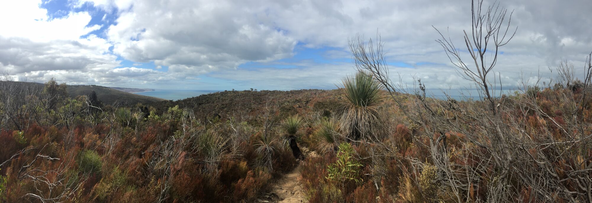
Up here the peninsula changes character completely. This is the Fleurieu's high country - green, wind-raked dairy and grazing ridges five hundred metres above the sea, with the Southern Ocean appearing and disappearing on your left and Backstairs Passage opening up ahead. It catches the highest rainfall on the peninsula, which is why it grows grass rather than grapes. There are no cellar doors. There is barely a town. That is the point.
Wind, grass and turbines
The high country announces itself with turbines. Near the southern end of the ridge, the 23 towers of Starfish Hill wind farm have been spinning since 2003 - it was South Australia's first wind farm, built here for the same reason the dairy farmers came: this ridge gets weather before anywhere else in the state. Depending on your taste they are either an intrusion or a kinetic sculpture park; on a clear day, with cloud shadows running across the paddocks beneath them, we lean toward the latter.
Parawa itself is a school, a hall, a fire shed and a scatter of farm gates. What it controls is access: nearly every gravel road heading south from the ridge dead-ends somewhere extraordinary.
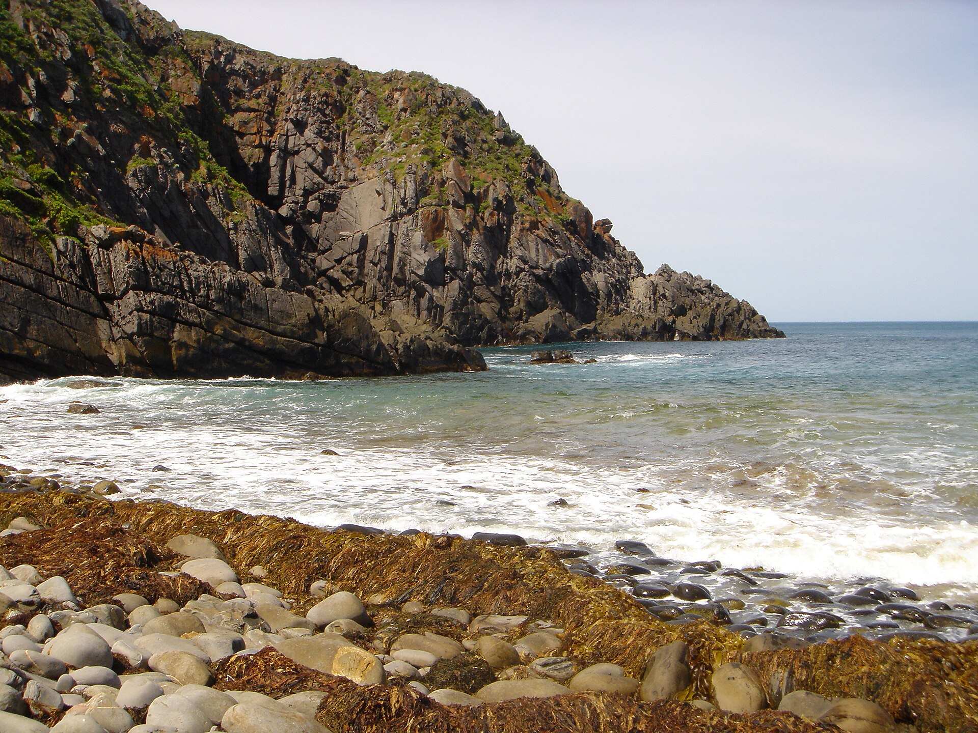
The turn-offs are the destination
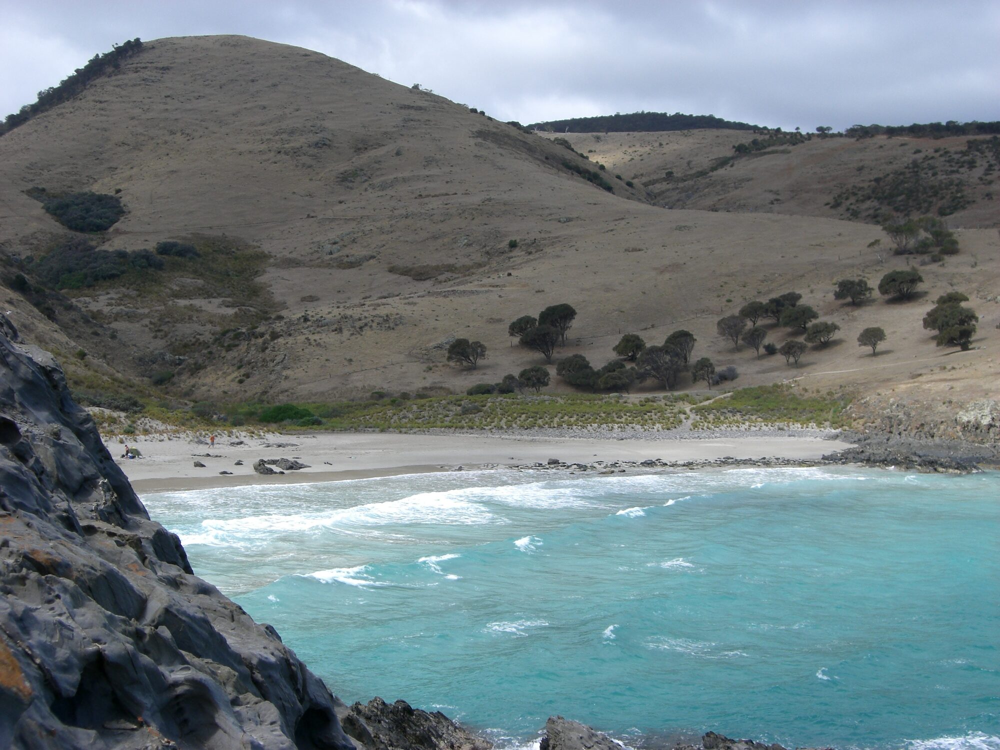
The most extraordinary of them is Tunkalilla Road, which tips you off the escarpment toward Tunkalilla Beach - five kilometres of empty Southern Ocean surf beach walled in by steep grassed hills, with no facilities, no phone reception to speak of, and frequently no other people. The final descent on foot is steep and the walk back up is honest work. It is, for our money, the wildest easily-reached place on the entire peninsula.
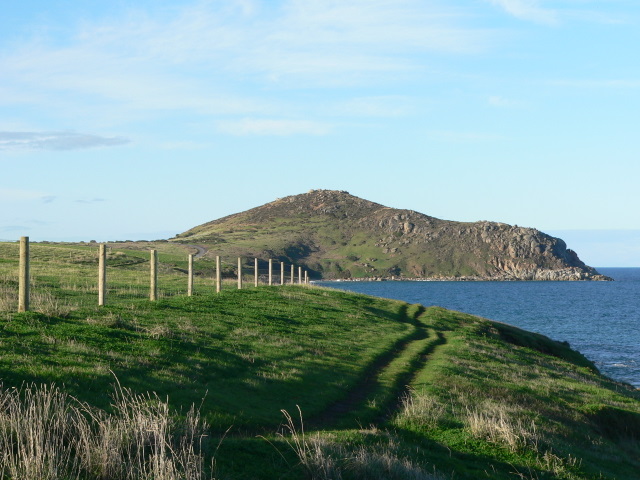
Further along, the ridge becomes the northern boundary of Deep Creek National Park, the Fleurieu's biggest wilderness area, and the high road becomes the way in to its campgrounds and trailheads. If you only make one stop inside the park, make it Tapanappa Lookout, where the cliffline drops away beneath you and Kangaroo Island lies across the water like a low cloud. The fit can continue down to Blowhole Beach; everyone else can simply stand at the rail and feel superior to the people queueing at a cellar door an hour north.
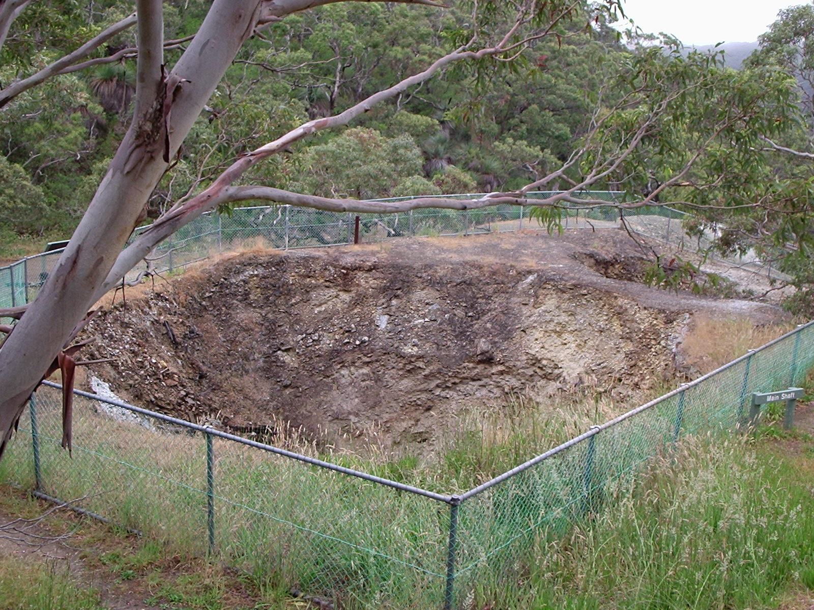
West of the park, the ruins of the 1860s silver-lead workings in Talisker Conservation Park add a strange, melancholy chapter to the ridge - Cornish-style mine chimneys in stringybark forest, a long way from Cornwall.
Practicalities
The high country is mostly unsealed once you leave the through road, and conditions change with the weather - take it slowly and watch for stock, kangaroos and milk tankers. Fuel and supplies are at Yankalilla or Normanville before you climb, and the Delamere General Store covers coffee, food and essentials at the ridge's southern end. There is no mobile coverage in several of the southern gullies, so download maps first.
The simplest way to taste it is to build the ridge into a loop: south along the coast, home across the top, or the reverse. Our McLaren Vale to Cape Jervis drive guide covers the full-length version of the journey south; the high country is what you add when the postcard Fleurieu starts to feel too easy.